In our new campaign, the Commanders-in-Chiefs have made their map moves, so it’s time for the first round of tabletop Crossfire battles.
It’s 04:30 18 June, and the night suddenly echoes to the roar of artillery. The 25 pounders of the Royal Field Artillery shell Juvigny and the surrounding area for over an hour and half. The Germans crouch lower in their entrenchments and wait for the wave of Tommies which will inevitably follow such a ‘softening up’. The bombardment finishes, and there is a brief respite before the first probing British rifle squads encounter German observation posts and forward defences in the grey light and damp of the dawn.
Perhaps unsurprisingly, the first attack is falling at dawn on the tip of the German front line, where the Germans are trying to hold the two bridges at Juvigny. The river is easily fordable, but with few major roads in the area, securing a decent crossing will facilitate the Allied advance.
We’re going to be staggering the games, probably playing around one a week in total, or one per month between individual players. This one should be played this Sunday (14 November).
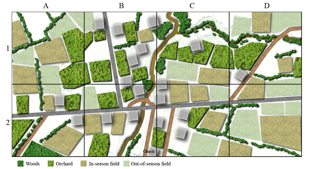
The first will be a good sized battle on a 4ft x 8ft table. As it hasn’t happened yet, I can’t share much detail other than to post up the map. The grid is in 2ftx2ft squares. The British are coming from the North.
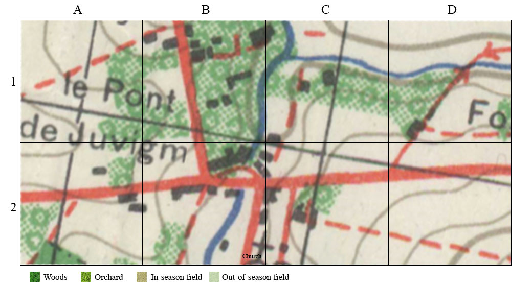
This based on this area of the 1940s 1:50,000 map
The map and the table don’t quite line up – mainly this is because when modern aerial photos are overlaid, it’s clear that the original map wasn’t all that accurate – some features are probably out by at least 50 to 100m, which could be a problem if you were calling in close-in artillery support…


Really looking forward to seeing how this campaign turns out.
Could you expand on the “map moves” section at the top. What rules did you use to govern that. What forces did commanders have access to, how did you deal with casualties during the campaign? Thinking of doing a map based campaign for the pacific. Would love more info on how you did this one!